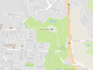
Click for Google Map (opens in a new window)

Hellyer County Park Velodrome strives to promote the sport of track cycling by offering diversified racing programs, developing athletes, providing healthy fitness programs for the community and bringing world-class track racing to the Northern California area. As the only velodrome in Northern California, we have a unique opportunity to attract championship cycling events and international racers, build a compelling race series and groom tomorrow’s Olympians.
Directions to the Track by Bike
Coyote Creek Trail, which is under the jurisdiction of the Santa Clara County Parks, runs through Hellyer park and right past the velodrome. This part of the Coyote Creek Trail is a 15-mile long, paved, mostly level multi-use trail that runs along Coyote Creek and highway 101 on the east side of San Jose. Hellyer County Park is along the trail near Yerba Buena Road. The trail continues north to Tully road and south through San Jose and the Coyote Valley, and ends near Anderson Lake County Park in Morgan Hill. Additional details: Hellyer Park Trail
Directions to the Track by Car
The track is located just off of Highway 101 at the Hellyer Ave. exit. From the 680/280/101 interchange take 101 south for 5 miles to the Hellyer Ave exit. At the bottom of the off-ramp turn right. At the stop sign go straight into Hellyer Park and follow the signs to the velodrome. The spectator gate is located on the south end of the velodrome (from the parking lot walk counter clock-wise around the track to get to the gate).

